Text。Photography:Cheng Mei Chi(Media Veteran)| Images:Paul Zimmerman
Many people think that Hong Kong has ‘everything’, but as early as 25 years ago, Paul Zimmerman felt that the city had ‘lost’ something important. Over the years, he has been trying hard to identify and address this loss. Born and raised in the Netherlands, he came to Hong Kong in the 1980s to assist his father with his Far East trading business. Since then, he worked in banking, public relations and design before giving up business in middle age to pursue a career in politics, particularly focusing on Hong Kong’s urban planning and development.
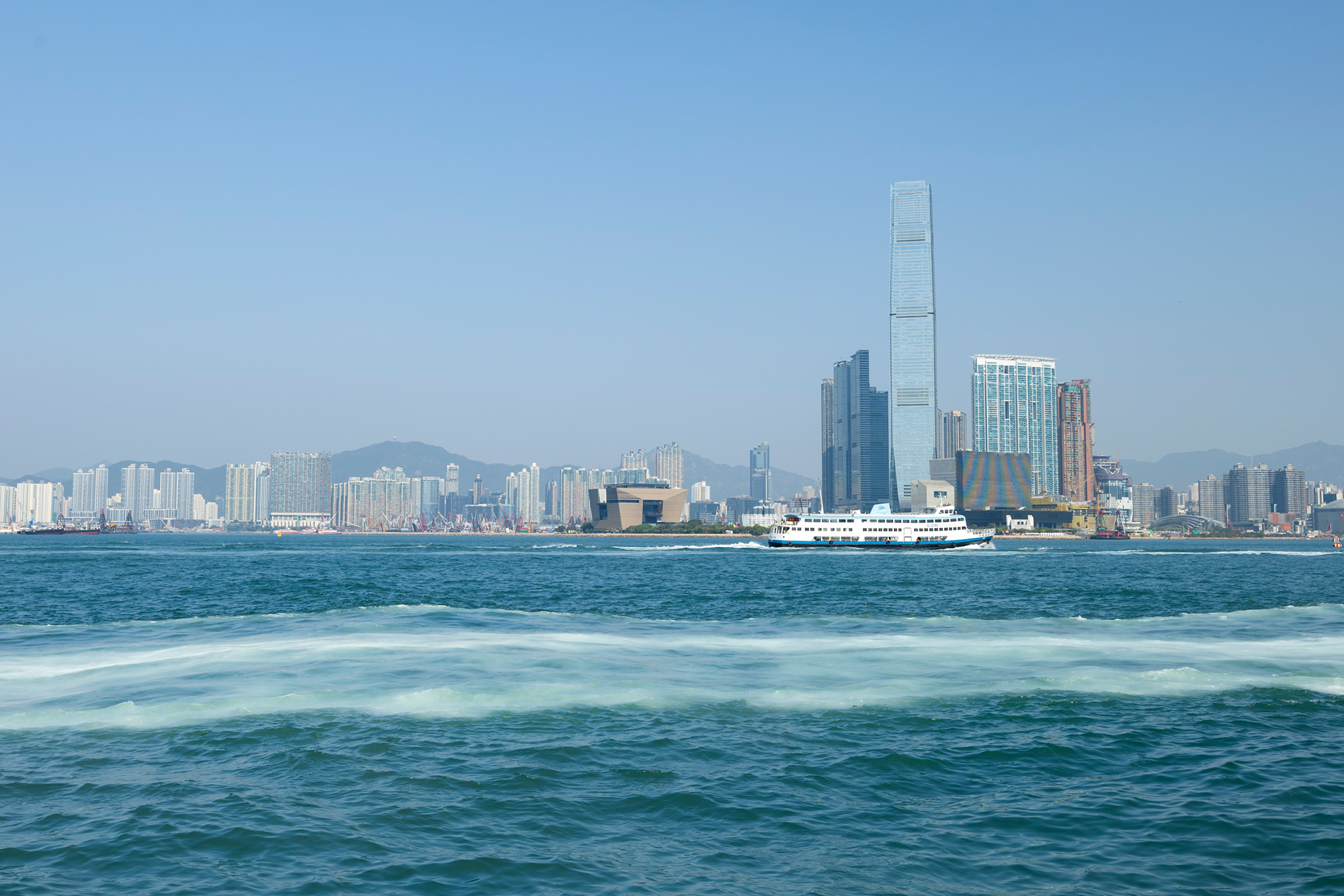
“It was in 2000 that I discovered the first missing link along the harbourfront,” says Paul. “At that time, I tried to walk along the harbourfront and found it impossible! There were always obstacles in the way, such as rubbish, fences and car parks. Sometimes there was no way to access the road at all.” Paul kept a detailed record of this, strolling along the whole of Hong Kong Island and the Kowloon Peninsula to take photos. He started the Harbourfront Project, which he has been working on for over 20 years and is still interested in today.

Paul’s computer shows his dream of Hong Kong that he has insisted on for more than two decades, a harbourfront path that connects the whole of Hong Kong Island, so that Hong Kong people of all ages and physical conditions can enjoy the beauty of the city.
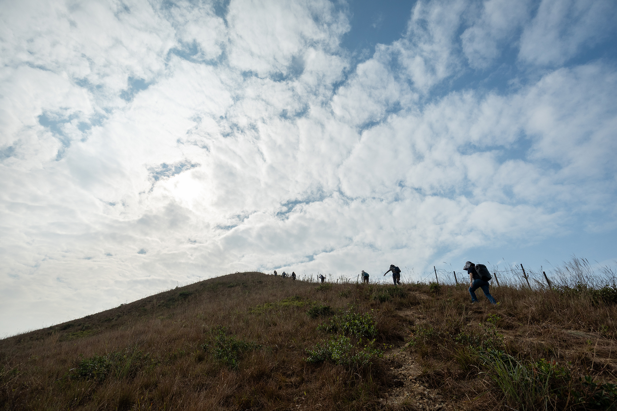
Since then, he has continued to study and advocate to the government for the entire harbourfront section to be linked up, turning the livelihood issue into a political one and promoting long-term urban development. This would provide the public with a coastal recreational area and a promenade. “While the mountains and hiking trails are more suitable for the able-bodied, the harbourfront is suitable for people of all ages, including the elderly, people with disabilities, and young children and pets, and is more accessible to all”.
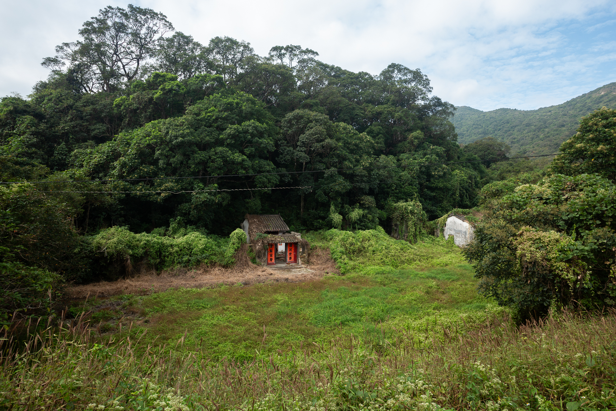
Starting from the harbourfront, Paul Zimmerman has gradually extended this blueprint to connect Hong Kong to other ‘missing links’ in the city and to missing links between the countryside and the city. “In terms of administrative structure, the Agriculture, Fisheries and Conservation Department (AFCD) is responsible for managing country parks. They have done a good job with the trails within the parks. However, the area between the parks and the city, known as the Green Belt, is under the jurisdiction of the Lands Department. The government has never paid any attention to these disappearing links and the trails connecting them, which were built by villagers and hikers.” Therefore, these trails created by the residents are not shown on official maps.
For example, Shek O Country Park is next to Tai Tam Country Park to the west. The two parks are adjacent, but are separated by Tai Tam Road, making it impossible for people to travel between them. ‘The distance between the two parks is only 10 metres, but that 10 metres is a road, not a footpath. If a bridge were to be built, hikers would be able to walk through the two parks in one go. He has tried many times to get the bridge built, but to no avail. ‘Who wants to pay for the bridge?’ No one is willing to.”
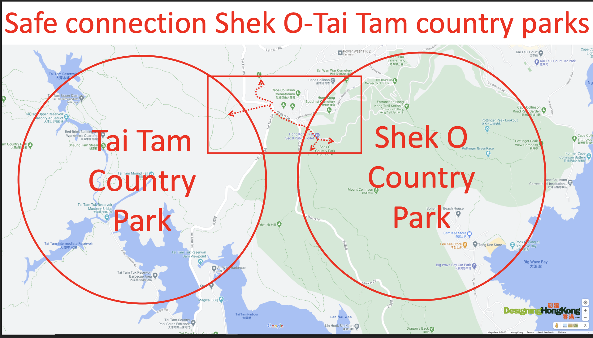
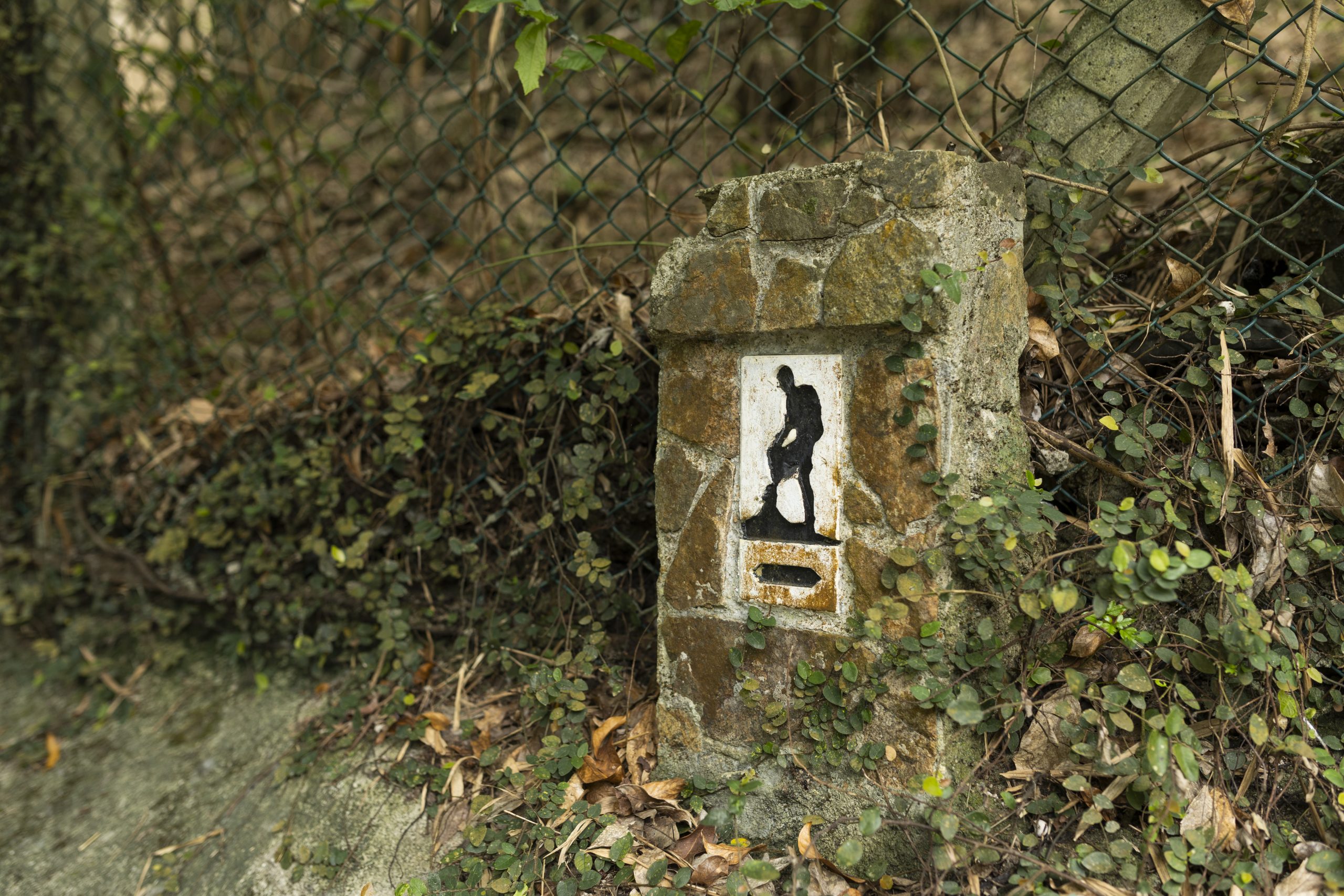
Tai Tam and Shek O Country Parks are separated by a 10-metre wide road, which has become one of the missing links.
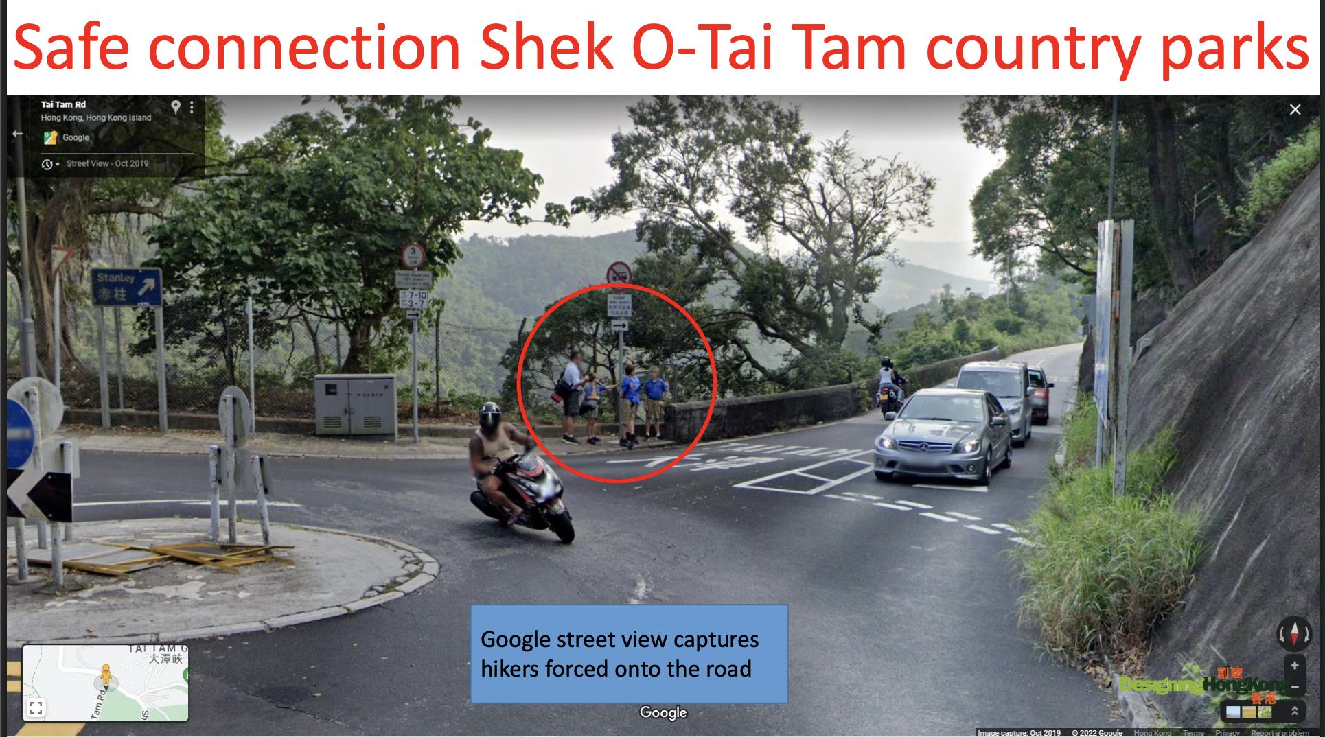
Google Street View captured people being forced to cross the road.
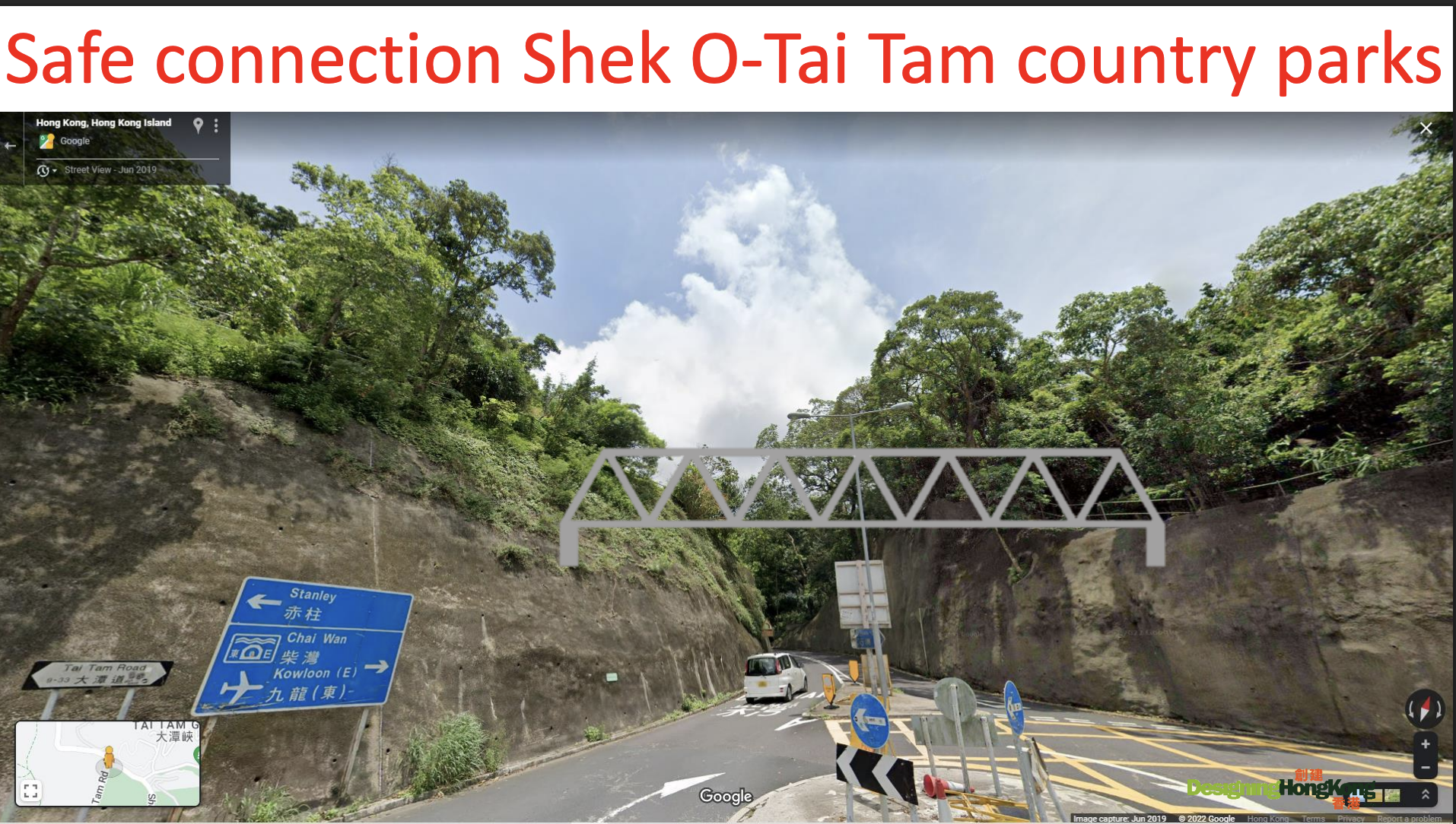
Paul Zimmerman has done a lot of research on this issue, hoping to push for the construction of a bridge or road to connect the two parks, “but unfortunately no one is willing to pay for it.”
Another ‘disappearing road section’ appeared in Pok Fu Lam. Paul Zimmerman, who was a member of the Southern District Council in 2013, recalled that he started to pay attention to the fact that there was a trail of great historical value between Kong Sin Wan Road and Victoria Road in Pok Fu Lam, which had been developed by villagers for generations. However, it had been sealed off by a fence, making both sides inaccessible and forcing people to go around a big hill to pass through.
“The villagers in the neighbourhood actually need the trail to get out, so some people who know what they’re doing will climb over the fence and use it.” As the trail is not shown on the official map, it has gradually been forgotten and fenced off over the years due to the government building roads and carrying out various projects in the neighbourhood, making it very difficult for the villagers to access. Paul has repeatedly raised the issue with the authorities and mobilised villagers to clean up the trail. Finally, in a rare example of successful advocacy, “the authorities agreed to unlock the fences and put up signs to let pedestrians know that they could use the trail, reconnecting Kong Sin Wan Road and Victoria Road!”
Over the past two decades, Paul has been documenting, reporting and urging the relevant departments to repair all the disappeared road sections in Hong Kong. Ask him how long it takes on average to ‘successfully fight’ for a change in each case, he frowned in concentration, “For example, we started proposing the harbourfront connection to the government around 2002, and we have finally seen a change. However, I believe that a lot of work still needs to be carried out before we can see the road sections fully connected. As for Kong Sin Wan Road mentioned just now, it has taken about eight to nine years for the project to come to fruition. If we want to talk about an average, it may take about 10 years!”