Text。Photography:Steffi Lau(Parks and Trails)
With the completion of the entire East Coast Boardwalk late last year, the 13-km-long harbourfront corridor along the northern coast of Hong Kong Island was officially opened in its entirety, becoming one of the attractions heavily promoted by the government this year. While the harbourfront spaces along the northern coast of Hong Kong Island have long been in place, North Point had previously been limited to a short 120-meter-long harbourfront “promenade” within the Provident Centre, accessible only via a passageway beneath the residential towers of the complex. The lack of public harbourfront space in North Point stems from historical reasons and shifts in land ownership over the years. After Cheung Kong and Hutchison Whampoa acquired the coastal land, the North Point harbourfront became part of Li Ka-shing’s empire, gradually taking on its current form through the development of multiple mixed-use districts. (For more on the planning evolution of North Point, please refer to our series of articles on the “Hong Kong Island Coastal Trail Challenge 2024/25,” produced in collaboration with City Unseen.)
Pedestrians walking along the East Coast Boardwalk can move unimpeded from Quarry Bay to Fortress Hill, yet it feels as though they are walking across a footbridge spanning the entire neighborhood, passing by North Point’s history without a second glance. They might overlook the fact that North Point was once a major industrial hub on Hong Kong Island. Located just outside Victoria City, North Point sits on the outskirts of the urban area. For instance, the North Point Power Station was built there because of its coastal location and relative distance from the city center. The names of nearby streets—Electric Road, Tin Chong Street, and Power Street—all reflect this history.
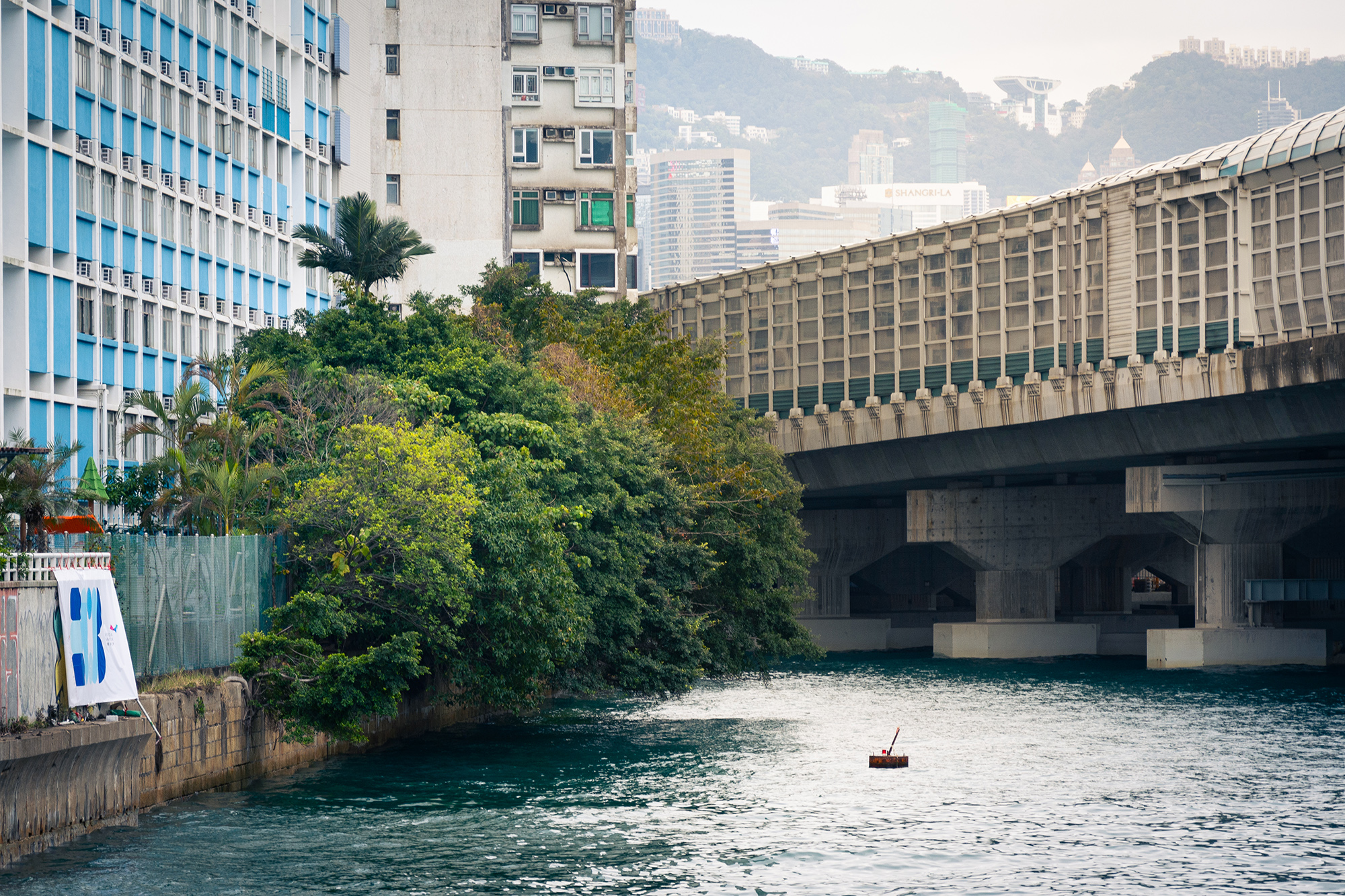
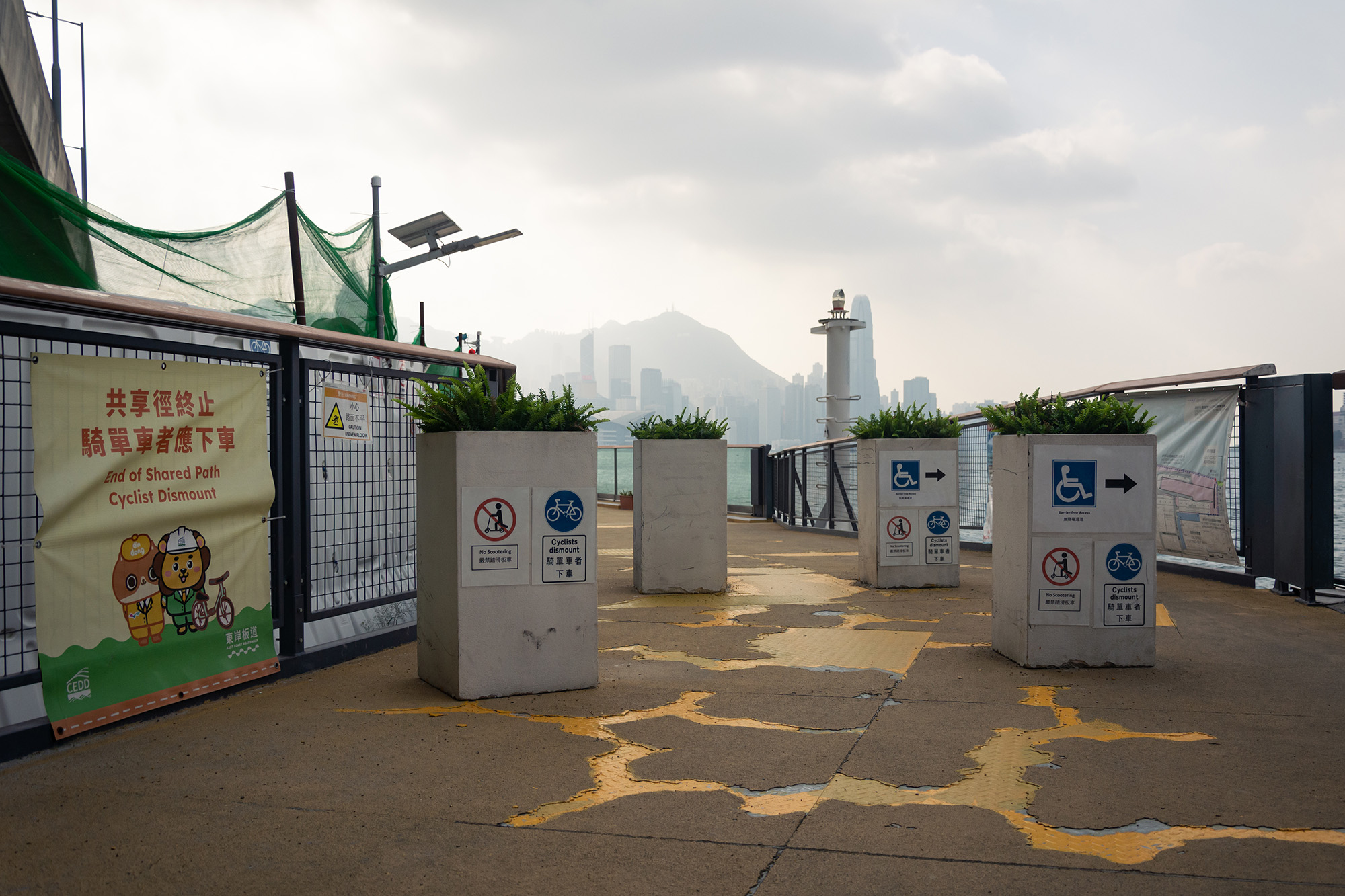
Looking back toward the North Point harbourfront from the East Coast Boardwalk, one can see the lack of public harbourfront space along the coast.
Following land reclamation in the 1950s, North Point became a site for increased industrial activity. A review of old maps reveals land designated for warehouses, sand storage, and lumber yards. Among these was the Chi Kee Sawmill & Timber, which has recently drawn public attention due to land acquisition in Kwu Tung. Chi Kee initially established its site on Java Road in North Point in 1947. It later relocated to Scout Hill in Chai Wan in 1956 due to the construction of North Point Estate, but moved again to the harbourfront when the area at the foot of Scout Hill was developed. Subsequently, it relocated to Sheung Shui in 1983 during the MTR development, and finally settled in Lin Ma Hang in 2026. Each relocation indirectly reflects the pace of urban development at the time.
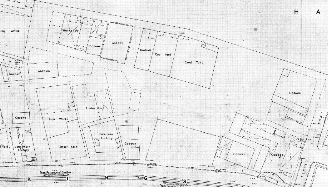
A look at old maps from 1959 reveals sites along the North Point coastline that were used for warehouses, sand pits, and lumber yards.。(Source:Hong Kong Historic Maps)
Moving away from the harbourfront to Health Village on the hillside, one finds the site of what was once the first government-run quarry. The Tsat Tsz Mui Government Quarry opened in 1915 to supply materials for infrastructure development. In 1954, to prevent noise and dust from affecting nearby residents, the government planned to close the quarry. The Tsat Tsz Mui Quarry bore witness to the development of Hong Kong’s mining industry, and its closure symbolized the changing role of North Point in Hong Kong.
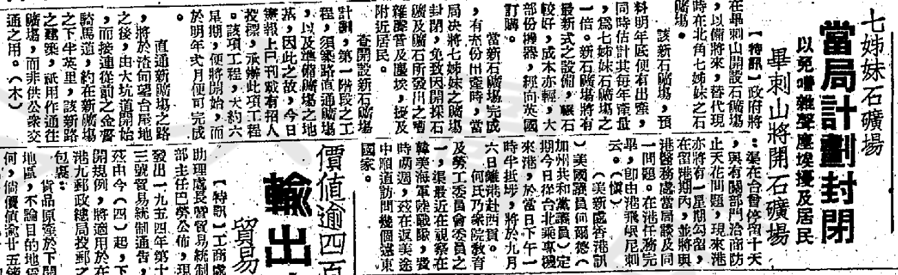
On September 4, 1954, the Overseas Chinese Daily Newsreported that the government planned to close the Tsat Tsz Mui Quarry.(Source:Digital Collection, Hong Kong Public Libraries)
As the urban area of Hong Kong Island gradually expanded, North Point gradually became a residential district. Located between the eastern and western sections of East Coast Boardwalk on the east coast are the recently completed Harbour North residential complex and an adjacent hotel. Between these and the Java Road Municipal Services Building lies a cross street named “North Point Estate Lane.” The current locations of the residential complex and hotel are precisely where the original North Point Estate, referenced in the street name, once stood. North Point Estate was the first low-rent housing estate built by the former Hong Kong Housing Authority. Many units offered views of Victoria Harbour, and the estate featured amenities such as shops, clinics, and a post office. It was also conveniently located near the North Point Ferry Pier and bus terminus, making it a well-equipped community that was often referred to as the “people’s luxury residence.” After North Point Estate was demolished in 2002, only North Point Estate Lane remains as a historical testament.
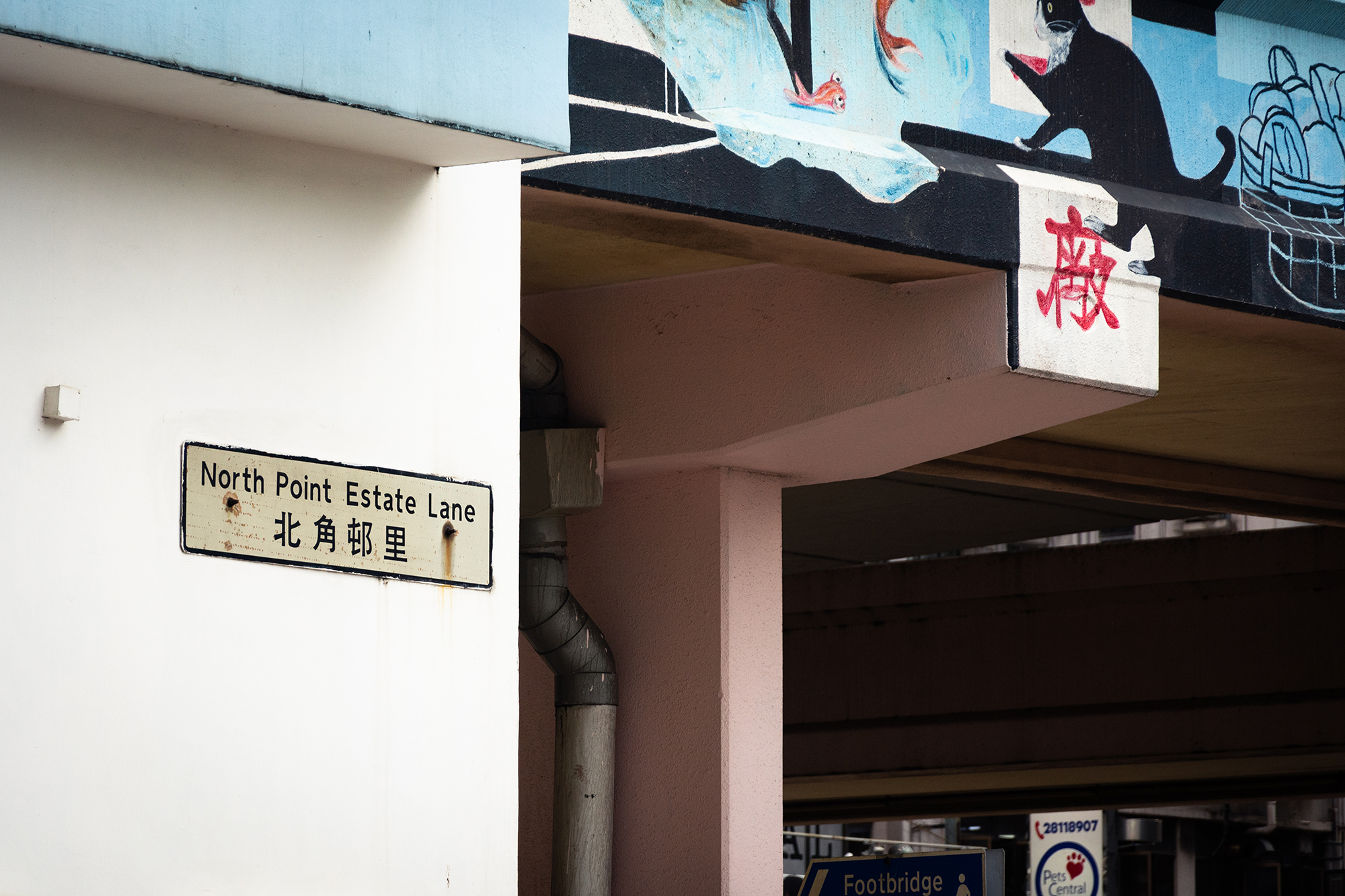
The only street sign in North Point Estate is mounted on the exterior wall of the Java Road Municipal Services Building.
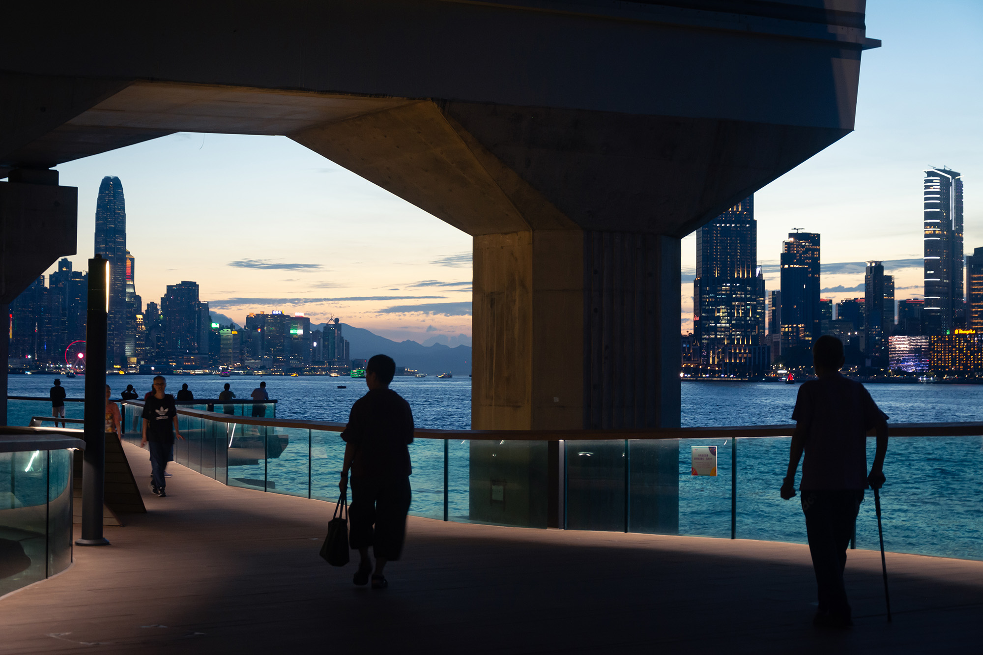
The East Coast Boardwalk connects to North Point’s harbourfront, though it actually bypasses North Point itself along the water’s edge. The viewing platform along the boardwalk draws pedestrians to pause and gaze at the skyline of Central’s skyscrapers at sunset. Perhaps the North Point neighborhood itself is also worth exploring in greater detail.

At sunset, pedestrians on the East Coast Boardwalk gaze at the Central skyline.
Reference
Please refer to Chinese version.
【 Subscribe to our newsletter to receive the latest articles by email. 】